|
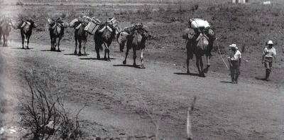
The stock route was originally established in the early years of the twentieth century as a droving route for cattle from Halls Creek
to Wiluna.
Today you will see herds of 4 wheel drives moving along the 1,800 kilometre track.
In the 1970s it was estimated that 50 vehicles a year traversed the track but by 1997 this figure had grown to 1,200 and has increased far beyond that now. Sadly
extra people means more problems. The track gets damaged, trees are cut down for firewood and rubbish gets dumped in pristine wilderness. It became necessary to
manage the track and a number of organisations including DEC, 4x4 clubs and the Keep Australia Beautiful Council joined together to educate
visitors about how to use the track properly.
The track was developed due to continued outbreaks of red water fever (caused by ticks) in the north east Kimberley. Stock were prevented
from being moved through non-tick infested areas and it was expensive for pastoralists to ship stock south. An inland route was needed that avoided other stocked areas.
The Canning Stock Route was first surveyed by Alfred Canning
in 1906. Canning was already experienced in travelling through rough arid land as he surveyed the
first rabbit proof fence that ran from Esperance to Eighty Mile Beach.

On the return trip from Halls Creek to Wiluna, Canning surveyed more well sites and at the site of Well 40 and altercation with a local Aborigine ended with
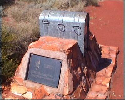
Michael Tobin (a well sinker) and the Aborigine being killed. Tobin's grave still exists near the well.
The track was put through by a team of 31 men in 1908. The men took along 267 goats as a mobile meat source and 70 camels to carry around 100 tons of supplies.
54 wells, an average of 27 kilometres apart, were sunk along the 1750km stock route that passes over the Gibson, Little Sandy and Great Sandy Desert. The work
took 18 months to complete.
The men operated in three teams with each team leap-frogging the others as wells were completed. Using this method one well was completed every 15 days.
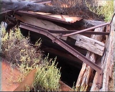
Each well had a 13 metre trough, whip pole, pulley and a hand operated windlass plus 2 x 45 litre buckets. Wells were lined with timber that was sourced
along the track.
Finding water along the route was essential and it was realised that the best way to do so was to get the information from local Aborigines. Unfortunately in
the early stages, the information was obtained under duress. Understandably the Aboriginal tribes did not want to hand out information on their precious water
supplies to strangers. In order to get the information Aborigines were captured and held in chains until they co-operated. Later as the explorers became familiar
with tribal customs and language, it was possible to get the information in a far less aggressive manner.
Evidence given by the expedition's cook (after Canning had fired him) led to a Royal Commission being held but despite tactics that today would have landed
Canning in very hot water, he was exonerated.

The first cattle drive took place in 1909 when Joseph McGee took stock down from Flora Valley to Wiluna. Another source states that the first commercial drive
was undertaken by George McIntyre in 1910 when he took horses from Pine Creek to Coorow.
In 1911 James Campbell Thompson, Shoesmith, and an Aborigine called Chinaman and possibly 3 other Aboriginal helpers, left Flora Valley Station in the Kimberley
with a mob of 150 cattle and travelled down the Canning Stock Route. When nothing was heard from them after 6 months an expedition was organised with police
officer Pliman in charge.
On reaching Well 35, Pilman found a group of Aborigines who claimed that the drovers had been killed by another tribe who were camped further north. At Well
37 Pilman found the grisly remains of the murdered men with the carcases of a horse and several cattle. (Another source says their bodies were discovered near
Well 37 by Cole and Pennyfather on June 29 1911.)
The party continued north and were running short of water when they came across an area where rains had recently fallen. They camped there for a few days in
order to recover and while they were resting a large group of Aborigines (about 70) appeared from the bush an attacked without warning. Luckily for the men on
the expedition they had guns primed and ready for just such an attack and they managed to drive the Aborigines off. As the tribe had now scattered into the
desert, Pilman had no choice but to continue north to Halls Creek and from there to Derby where they took a ship back to
Perth without having managed to bring the murderers to justice.
The Aboriginal tribes that inhabited the area remained hostile to the drovers. A number of people were speared, with reports of deaths still occurring as
late as 1936.

The Aboriginal people resented the intrusion into their lands and by 1917 about half the wells had been deliberately damaged in an attempt to stop drovers
from using them. Few people wanted to risk using the track for fear of attacks and as a result the route was used only occasionally to move stock.
A partial refurbishment of some wells was undertaken by William Snell in 1929 but he failed to complete the task. The government then asked Canning to return
and complete the task which he did despite being 70 years old. The refurbishment of the wells took Canning 16 months but despite the effort, only 20 cattle
mobs completed the route between 1932 and 1959. In total there had only been 30 recorded cattle drives along the track.
The route fell into disuse after 1959 and was almost lost to history until the explosion of 4 wheel drive ownership in Australia. The first motor vehicle
survey of the track was done in 1963 and took just 5 weeks.
By 1977 a commercial operator was taking tourists along the track and the stock route suddenly had a new lease of life.
Today fuel supplies are available at Wiluna, Kunawarritju Community, Billiuna Community and Halls Creek. The best time to travel the track is between May
and October. Anyone attempting this route must be well prepared and ideally should travel in convoy with other people.
Some unusual methods of traversing the track include bicycle, walking and 2 wheel drive vehicles, none of which we would recommend.
The following information is from the Wiluna Shire website and concerns conditions of use of the stock route sections:
All three CSR access routes are through private land using station tracks. Conditions have been placed on their use.
Travel is entirely at your own risk. Stay on the approved sign-posted track - never deviate. No travel when the track is closed (wet) and no shooting is allowed.
CUNYU SECTION:
- Well 3 to Well 4B
- No trailers and wide track vehicles
- The track is rough, narrow, winding and not maintained
- Carry own water
- Camp at Well 3 or Windich only
- Granite Peak: Well 5 and Glen Ayle: Well 9
- A track maintenance fee is charged:-
- Standard 4x4 $20, trailer $10 Bus type vehicle $40
- Roads to homesteads are Shire maintained
- Access for trailers and large vehicles
Campsites along the track:
- Well 3
- Windich Springs
- Well 6
- Well 7
- Well 12
- Durba Springs
- Desert Oaks near Lake Disappointment between Wells 20 and 21
- Well 24
- Well 26
- Well 28
- Well 30 Desert Oaks
- Bungabinni Well
- Well 37
- Well 41
- Well 46
- Breaden Hills
- Well 49
Emergency Exits
In the event of rain, vehicle problems, supply shortage or illness, it may be necessary to make an emergency exit off the track.
Exit to the west on the Talawana Track between Wells 22 and 23, or on the Kidman track near Well 33.
On these same tracks you can also exit to join the Gary 'Highway' (but there are no facilities here either), or head east from Well 5 or 9 to join the
track to Glen Ayle Station (permission is needed to use this track).
Fuel Requirements
Fuel consumption on the firmer sections of track will be similar to normal consumption rates if driving at moderate speed. Allow up to DOUBLE or TRIPLE
the consumption rate for the dune sections due to soft sand conditions, tortuous track and repeated short run-ups.
Extra fuel can be carried in long range tanks or jerry cans.
Carrying fuel cans inside the vehicle is not recommended, but beware of overloading roofracks (risk of breakage and greater risk of rollover) - empty
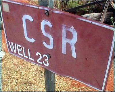
the jerries into the main tank as soon as possible. Virtually ALL travellers require a fuel dump - usually near Well 23. Fuel is ordered by the 44-gallon
drum (200 litres) from Newman (See Capricorn Roadhouse number below). It must be ordered and paid for a few months in advance.
Remember to bring a small pump to transfer the fuel!
HF RADIO IS ESSENTIAL IN THIS AREA. Radios can be hired and the cost shared by the convoy.
|
Capricorn Roadhouse
|
08 9175 1535
|
|
Police - Halls Creek
|
08 9168 9777
|
|
Police - Newman
|
08 9175 4000
|
|
Police - Wiluna
|
08 9981 7024
|
|
Royal Auto Club of WA
|
13 11 11
|
Best time to visit:
|
Jan
|
Feb
|
Mar
|
Apr
|
May
|
Jun
|
Jul
|
Aug
|
Sep
|
Oct
|
Nov
|
Dec
|
|


