DESCRIPTION
Gingin is a pretty little town about 4km east of the Brand Highway.
There are some interesting historic buildings, and a central park and pool make the slight detour worth while.
The area is primarily involved with agriculture and various enterprises include olive growing, fruit, beef, sheep and cereal
cropping.
The name comes from the Aboriginal language and may mean 'footprint' or possibly 'place of streams.'
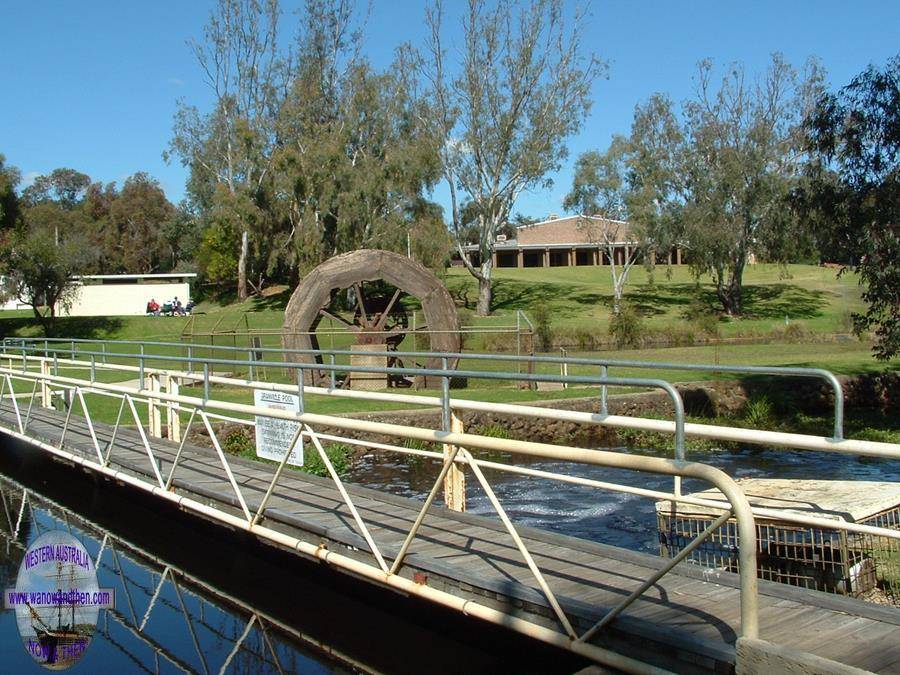
Gingin Brook flows through Granville Park and the brook is the only perennial stream that exists between Perth and the
Kimberleys far to the north east.
The large water wheel is a replica of one that once drove a flour mill on Cheriton Farm.
The stream is fed by springs coming from peat banks which is also a unique occurrence in W.A.
The meandering brook has created a swamp thicket where you will find a raised walkway that leads you though stands of
paperbarks and flooded gums.
Twining bladder-wort, helmet orchid and a tropical fern can all be found here many miles north of their usual habitats.
Gravity Discovery Centre
Gravity is something we all take for granted but it is a force that is vital. At the Gravity Discovery Centre you can learn about gravity through a number of hands on
exhibits and interactive displays. Science can be both useful and fun. Phone 08 9575 7577 or visit the website
for more information.
HISTORY
Settlement in the area dates from the 1830s after Robert Dale and
Edward Barrett-Lennard stumbled across the area while looking for stray cattle.
George Fletcher Moore's
map of the area (made in 1836) shows the name 'Jinjin' spelled with Js and not Gs but a later
survey by W L Brockman in 1843 shows the spelling as 'Gingin' with Gs.
The first school in Gingin opened on the 18th of August 1862 and a festival was held to celebrate the occasion.
The school opened and closed and changed location over the next few years and the education of local children seemed to be a bit
hap-hazard until 1881 when things started to settle down and a teacher was found who would stay for the next 9 years.
Initially it was suggested that the new townsite be called Frogmore but this was dismissed by the locals.
Granville was then suggested and a townsite (about 3.5 kilometres from the current site) was gazetted in 1869.
Only two of the 134 town lots were purchased as the site was not popular with locals. Finally a new townsite called Gingin was
gazetted in 1883.
In 1886 a telegraph line to Perth was completed and in 1891 the railway arrived.
Most towns started off with a 'Road Board' that was responsible for collecting taxes and using the proceeds to build bridges
and roads in their allotted zones. These boards then progressed to become local councils with responsibility for much more
than just roads.
The Swan Road Board administered the Gingin area from 1871 to 1893 when the Gingin Road Board was formed.
Unusually Gingin also had a Municipal Council at the same time but the town was far too small to support both and in the
end the Council was dissolved in 1903 and its assets and responsibilities taken over by the Road Board.
In the early days Gingin developed a beef and dairy industry and in the early 1900s became famous for the production of
oranges. Today sheep, wheat and cattle are the areas main industries.
TALL TALES AND TRUE
Poisoned flour
John Death (an appropriate name as it turns out) worked for Joshua Edwards and had a small shack where he kept his belongings.
On a number of occasions his hut was raided by Aborigines while he was away and flour, tea, tobacco and the like were taken.
Death placed a sign in front of his hut stating 'NOTICE. POISON FLOUR MEAL' and he even informed the local policeman that he had the strychnine laced flour to get rid of wild dogs.
Of course the inevitable happened and the Aborigines ' who could not read the sign ' stole the flour and a young child died as a result.
Death was charged over the matter but no records can be found to shed light on the outcome of the case. Death drowned in Gingin Brook in 1872.
VIDEO
PROBLEM PLAYING THESE ON FIREFOX?
Turn off Enhanced Tracking Protection
Click the shield icon left of the URL near the top left
Slide Advanced Tracking Protection to OFF
Check out our other VIDEOS
NEW **** CLICKABLE VIDEO MAPS **** NEW
Video available from April 27th 2024
Check out our other VIDEOS
NEW **** CLICKABLE VIDEO MAPS **** NEW
OTHER INFORMATION
ATTRACTIONS
Moondah Brook Vineyard, Walkabout trail, Dewar's House, Granville, West Coast Honey, Gravity Discovery Centre, British car rally on the third Sunday of May.
BUILDINGS OF NOTE
St. Luke's, Brockman & Weld Sts. 1861, Old railway station 1891, Uniting church 1870.
ELECTORAL ZONES
State : Moore
Federal : Pearce
OTHER INFO.
Postcode : 6503
Local Government : Shire of Gingin
PHOTOS
Sadly something has disabled these photo sections on our website.
We don't know what it is or how to fix it.
Aplolgies for the inconvenience. We will work on finding a way round it.


